

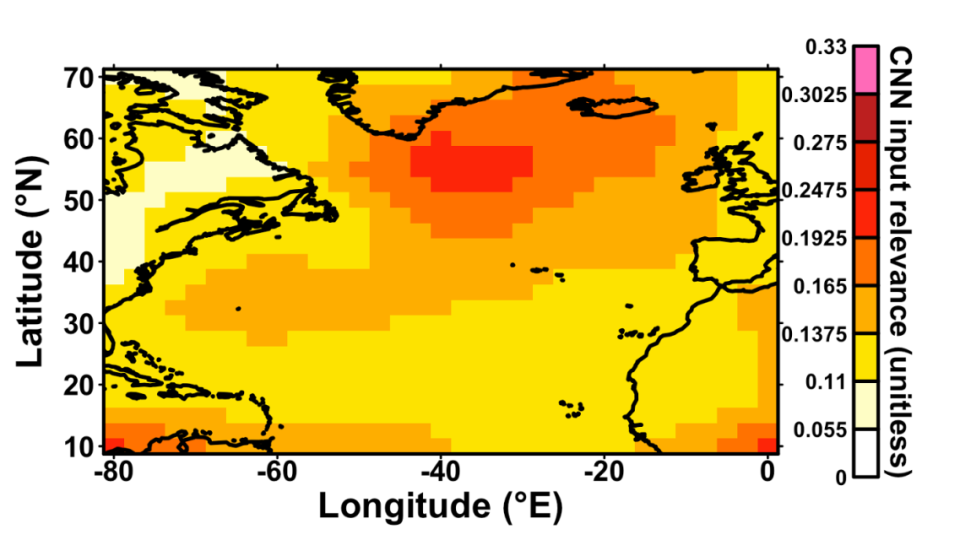
Neural-network input relevance for classifying climate models from simulated surface air temperature fields
Simon Michel led a study in collaboration with other group members and EERIE partners that uses deep learning and explainable AI to analyse the day-to-day imprint of ocean mesoscale variability on simulated surface air temperature fields in climate models. The 17 models investigated span a wide range of resolutions: atmospheric resolution varies from approximately 250 km down to 10 km, while ocean resolution ranges from coarse configurations in which mesoscale eddies are parameterised to eddy-permitting and eddy-resolving configurations in which they are increasingly explicitly simulated.
Daily surface air temperature snapshots from all models are pooled together and passed to a convolutional neural network whose task is to identify which model generated each field. Although the network is given no information about model resolution, a clear pattern emerges from its predictions: most classification errors occur between models sharing a similar ocean resolution.
Explainable artificial intelligence is then used to determine where the distinctions associated with ocean resolution originate. The neural network focuses predominantly on regions of strong mesoscale ocean activity, such as western boundary currents and the Southern Ocean, showing that differences in the representation of ocean eddies leave a detectable imprint on day-to-day atmospheric temperature variability. The results confirm that increasing ocean resolution leads to a step change in atmosphere–ocean interactions and in the spatial structure of simulated near-surface atmospheric variability.
The paper was recently accepted for publication in AI for Earth Systems.