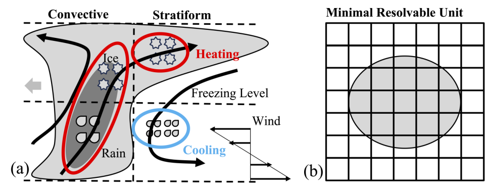
A schematic representing the typical structure of a Mesoscale Convective System. Panel b) indicates that such a system is poorly represented by weather and climate model, as it is neither large enough to be explicitly represented, nor small enough to be accurately approximated through parametrisation.
Credit: Z. Zhang
Research group
Mesoscale convective systems (MCSs) are a type of severe storm with wide spreading and extreme rainfall spanning areas over 100 km. They play a vital role in global rainfall patterns, shaping both weather and climate. However, forecast models struggle to represent these systems. To address this, Zhixiao Zhang (from our research group here in Oxford) and Mark Muetzelfeldt (University of Reading) have implemented a representation of these severe organised thunderstorms into the UK Met Office's weather forecasting model. This "Multiscale Coherent Structure Parameterization (MCSP)" scheme is designed to improve MCS representation when large-scale conditions favour their development. We find a significant improvement in rainfall patterns over India and the Indian Ocean. The scheme also enhances the Madden-Julian Oscillation, which is a crucial link between weather and climate prediction.
For more information, check out Zhixiao's paper, just accepted in JAMES.