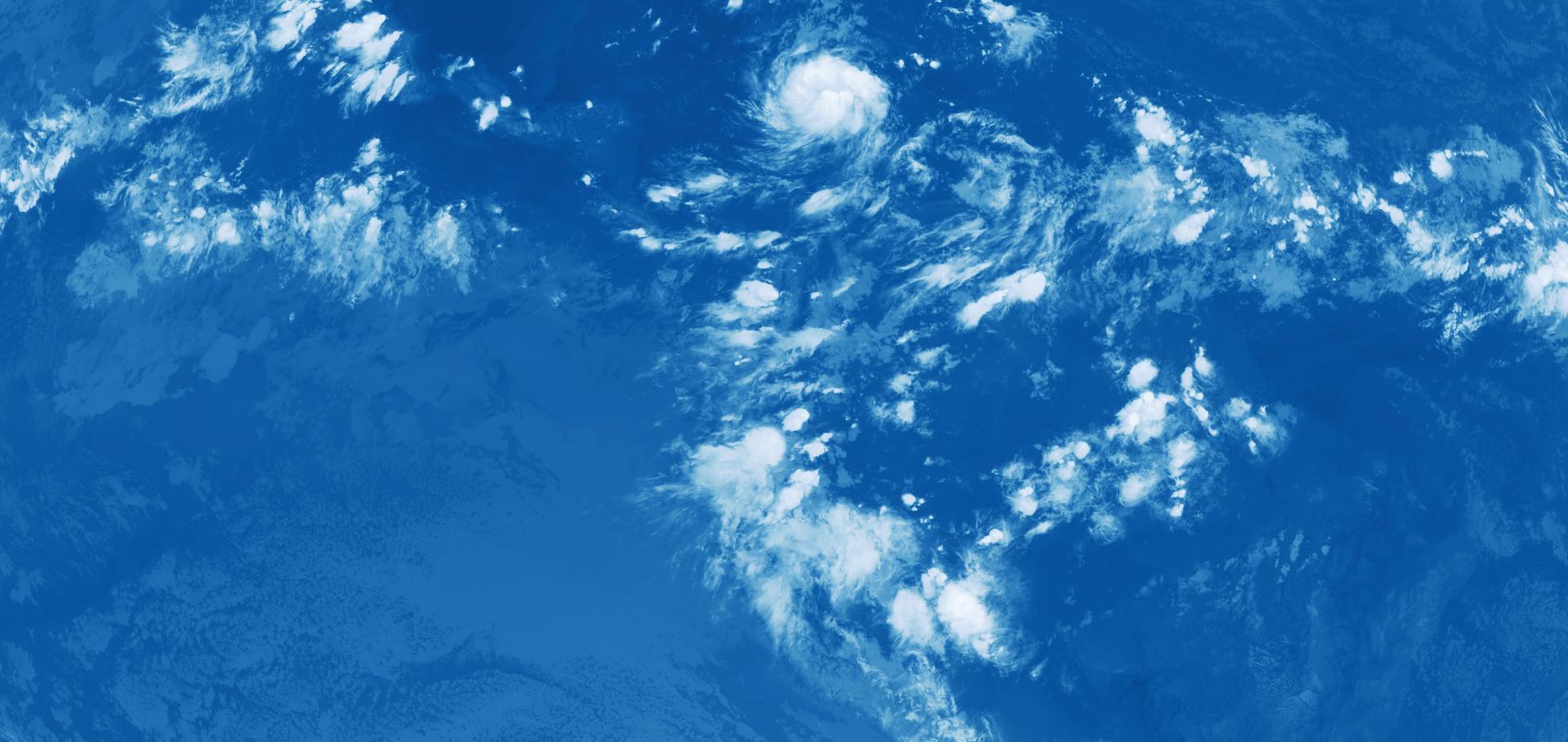

Spatial Patterns of Shallow Clouds: Challenging the Concept of Defined Regimes
Geophysical Research Letters Wiley 53:8 (2026) e2025GL119921
Abstract:
Plain Language Summary: The representation of tropical shallow cloud systems is a major source of uncertainty in climate models. Shallow clouds have previously been observed to organize in a variety of patterns. Four distinct classes—fish, flowers, sugar, and gravel—were identified, each with differing spatial scales of cloud organization. Here we analyze high‐resolution geostationary visible and infrared satellite images using a function that can objectively assess organization of cloudy pixels across all spatial scales. We see that examples of the four “classical” patterns are clearly identifiable using this function, but that they do not show up as clearly preferred regimes, but rather as way‐markers in a smoothly evolving sea of cloud patterns. This means that representing these patterns in parameterization schemes might be challenging.A generative likelihood framework for high-resolution climate model evaluation
Environmental Data Science Cambridge University Press (CUP) 5 (2026)
Abstract:
Abstract Next-generation high-resolution (km-scale) climate models promise unprecedented accuracy in climate projections, but realizing their potential requires robust methods to quantify how well simulations align with real-world observations. Average-based metrics conventionally used for climate model evaluation ignore the physics encoded in the fine-scale structures of km-scale simulations. To overcome this limitation, we propose a novel, statistically principled evaluation methodology based on the likelihood function of a generative image model. Our method provides a continuous similarity metric derived from the likelihood distribution of observation and simulation snapshots, which can redefine the evaluation, intercomparison, and parameter tuning of high-resolution climate models. We demonstrate the applicability and interpretability of this method by evaluating convective clouds simulated by two state-of-the-art global km-scale models, using their outgoing infrared radiation fields. This work establishes a scalable pathway toward observation-based evaluation of next-generation climate simulations.Image calibration between the Extreme Ultraviolet Imagers on Solar Orbiter and the Solar Dynamics Observatory
Astronomy and Astrophysics 703 (2025)
Abstract:
To study and monitor the Sun and its atmosphere, various space missions have been launched in the past decades. With rapid improvement in technology and different mission requirements, the data products are subject to constant change. However, for such long-term studies as solar variability or multi-instrument investigations, uniform data series are required. In this study, we built on and expanded the instrument-to-instrument translation (ITI) framework, which provides unpaired image translations. We applied the tool to data from the Extreme Ultraviolet Imager (EUI), specifically the Full Sun Imager (FSI) on Solar Orbiter and the Atmospheric Imaging Assembly (AIA) on the Solar Dynamics Observatory (SDO). This approach allowed us to create a homogeneous dataset that combines the two extreme ultraviolet (EUV) imagers in the 174/171 Å and 304 Å channels. We demonstrate that ITI is able to provide image calibration between Solar Orbiter and SDO EUV imagers, independent of the varying orbital position of Solar Orbiter. The comparison of the intercalibrated light curves derived from 174/171 Å and 304 Å filtergrams from EUI and AIA shows that ITI can provide uniform data series that outperform a standard baseline calibration. We evaluate the perceptual similarity in terms of the Fréchet inception distance, which demonstrates that ITI achieves a significant improvement of perceptual similarity between EUI and AIA. The study provides intercalibrated observations from Solar Orbiter/EUI/FSI with SDO/AIA, enabling a homogeneous dataset suitable for solar cycle studies and multi-viewpoint investigations.nextGEMS: entering the era of kilometer-scale Earth system modeling
Geoscientific Model Development Copernicus Publications 18:20 (2025) 7735-7761
Abstract:
Abstract. The Next Generation of Earth Modeling Systems (nextGEMS) project aimed to produce multidecadal climate simulations, for the first time, with resolved kilometer-scale (km-scale) processes in the ocean, land, and atmosphere. In only 3 years, nextGEMS achieved this milestone with the two km-scale Earth system models, ICOsahedral Non-hydrostatic model (ICON) and Integrated Forecasting System coupled to the Finite-volumE Sea ice-Ocean Model (IFS-FESOM). nextGEMS was based on three cornerstones: (1) developing km-scale Earth system models with small errors in the energy and water balance, (2) performing km-scale climate simulations with a throughput greater than 1 simulated year per day, and (3) facilitating new workflows for an efficient analysis of the large simulations with common data structures and output variables. These cornerstones shaped the timeline of nextGEMS, divided into four cycles. Each cycle marked the release of a new configuration of ICON and IFS-FESOM, which were evaluated at hackathons. The hackathon participants included experts from climate science, software engineering, and high-performance computing as well as users from the energy and agricultural sectors. The continuous efforts over the four cycles allowed us to produce 30-year simulations with ICON and IFS-FESOM, spanning the period 2020–2049 under the SSP3-7.0 scenario. The throughput was about 500 simulated days per day on the Levante supercomputer of the German Climate Computing Center (DKRZ). The simulations employed a horizontal grid of about 5 km resolution in the ocean and 10 km resolution in the atmosphere and land. Aside from this technical achievement, the simulations allowed us to gain new insights into the realism of ICON and IFS-FESOM. Beyond its time frame, nextGEMS builds the foundation of the Climate Change Adaptation Digital Twin developed in the Destination Earth initiative and paves the way for future European research on climate change.Discovering convection biases in global km-scale climate models using computer vision
Copernicus Publications (2025)