Surprising similarities in model and observational aerosol radiative forcing estimates
Atmospheric Chemistry and Physics Copernicus GmbH 20:1 (2020) 613-623
Abstract:
Next-generation geospatial-temporal information technologies for disaster management
IBM Journal of Research and Development IBM 64:1/2 (2020) 5:1-5:12
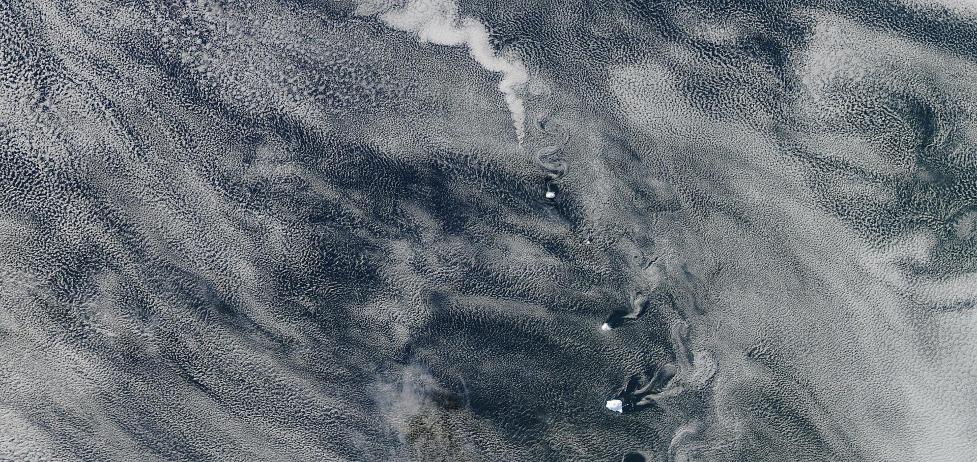
Aerosols enhance cloud lifetime and brightness along the stratus-to-cumulus transition
Proceedings of the National Academy of Sciences National Acad Sciences 117 (2020) 30
Revisiting the 1888 Centennial Drought
Proceedings of the Royal Society of Victoria CSIRO Publishing 132:2 (2020) 49-64
Learning and Recognizing Archeological Features from LiDAR Data
2019 IEEE International Conference on Big Data (Big Data) IEEE (2019) 5630-5636