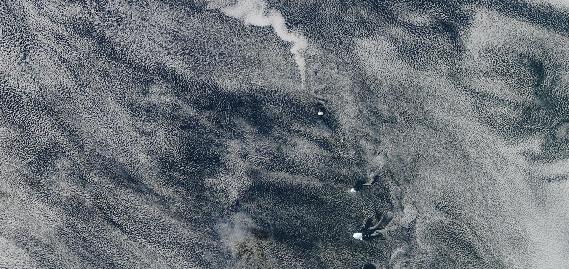
Constraining the Twomey effect from satellite observations: issues and perspectives

Atmospheric Chemistry and Physics Discussions European Geosciences Union 20:23 (2020) 15079-15099

Authors:

Johannes Quaas, Arola Antti, Brian Cairns, Matthew Christensen, Hartwig Deneke, Annica ML Ekman, Graham Feingold, Ann Fridlind, Edward Gryspeerdt, Otto Hasekamp, Zhanqing Li, Antti Lipponen, Po-Lun Ma, Johannes Muelmenstaedt, Athanasios Nenes, Joyce Penner, Daniel Rosenfeld, Roland Schroedner, Kenneth Sinclair, Odran Sourdeval, Philip Stier, Matthias Tesche, Bastiaan van Dieedenhoven, Manfred Wendisch

Abstract:

The Twomey effect describes the radiative forcing associated with a change in cloud albedo due to an increase in anthropogenic aerosol emissions. It is driven by the perturbation in cloud droplet number concentration (ΔNd, ant) in liquid-water clouds and is currently understood to exert a cooling effect on climate. The Twomey effect is the key driver in the effective radiative forcing due to aerosol–cloud interactions, but rapid adjustments also contribute. These adjustments are essentially the responses of cloud fraction and liquid water path to ΔNd, ant and thus scale approximately with it. While the fundamental physics of the influence of added aerosol particles on the droplet concentration (Nd) is well described by established theory at the particle scale (micrometres), how this relationship is expressed at the large-scale (hundreds of kilometres) perturbation, ΔNd, ant, remains uncertain. The discrepancy between process understanding at particle scale and insufficient quantification at the climate-relevant large scale is caused by co-variability of aerosol particles and updraught velocity and by droplet sink processes. These operate at scales on the order of tens of metres at which only localised observations are available and at which no approach yet exists to quantify the anthropogenic perturbation. Different atmospheric models suggest diverse magnitudes of the Twomey effect even when applying the same anthropogenic aerosol emission perturbation. Thus, observational data are needed to quantify and constrain the Twomey effect. At the global scale, this means satellite data. There are four key uncertainties in determining ΔNd, ant, namely the quantification of (i) the cloud-active aerosol – the cloud condensation nuclei (CCN) concentrations at or above cloud base, (ii) Nd, (iii) the statistical approach for inferring the sensitivity of Nd to aerosol particles from the satellite data and (iv) uncertainty in the anthropogenic perturbation to CCN concentrations, which is not easily accessible from observational data. This review discusses deficiencies of current approaches for the different aspects of the problem and proposes several ways forward: in terms of CCN, retrievals of optical quantities such as aerosol optical depth suffer from a lack of vertical resolution, size and hygroscopicity information, non-direct relation to the concentration of aerosols, difficulty to quantify it within or below clouds, and the problem of insufficient sensitivity at low concentrations, in addition to retrieval errors. A future path forward can include utilising co-located polarimeter and lidar instruments, ideally including high-spectral-resolution lidar capability at two wavelengths to maximise vertically resolved size distribution information content. In terms of Nd, a key problem is the lack of operational retrievals of this quantity and the inaccuracy of the retrieval especially in broken-cloud regimes. As for the Nd-to-CCN sensitivity, key issues are the updraught distributions and the role of Nd sink processes, for which empirical assessments for specific cloud regimes are currently the best solutions. These considerations point to the conclusion that past studies using existing approaches have likely underestimated the true sensitivity and, thus, the radiative forcing due to the Twomey effect.

Constraining the Twomey effect from satellite observations: issues and perspectives

ATMOSPHERIC CHEMISTRY AND PHYSICS Copernicus GmbH 20:23 (2020) 15079-15099

Authors:

Johannes Quaas, Antti Arola, Brian Cairns, Matthew Christensen, Hartwig Deneke, Annica ML Ekman, Graham Feingold, Ann Fridlind, Edward Gryspeerdt, Otto Hasekamp, Zhanqing Li, Antti Lipponen, Po-Lun Ma, Johannes Mulmenstadt, Athanasios Nenes, Joyce E Penner, Daniel Rosenfeld, Roland Schroedner, Kenneth Sinclair, Odran Sourdeval, Philip Stier, Matthias Tesche, Bastiaan van Diedenhoven, Manfred Wendisch

Abstract:

© 2020 BMJ Publishing Group. All rights reserved. The Twomey effect describes the radiative forcing associated with a change in cloud albedo due to an increase in anthropogenic aerosol emissions. It is driven by the perturbation in cloud droplet number concentration (1Nd; ant) in liquid-water clouds and is currently understood to exert a cooling effect on climate. The Twomey effect is the key driver in the effective radiative forcing due to aerosol cloud interactions, but rapid adjustments also contribute. These adjustments are essentially the responses of cloud fraction and liquid water path to 1Nd; ant and thus scale approximately with it. While the fundamental physics of the influence of added aerosol particles on the droplet concentration (Nd) is well described by established theory at the particle scale (micrometres), how this relationship is expressed at the large-scale (hundreds of kilometres) perturbation, 1Nd; ant, remains uncertain. The discrepancy between process understanding at particle scale and insufficient quantification at the climate-relevant large scale is caused by co-variability of aerosol particles and updraught velocity and by droplet sink processes. These operate at scales on the order of tens of me-Tres at which only localised observations are available and at which no approach yet exists to quantify the anthropogenic perturbation. Different atmospheric models suggest diverse magnitudes of the Twomey effect even when applying the same anthropogenic aerosol emission perturbation. Thus, observational data are needed to quantify and constrain the Twomey effect. At the global scale, this means satellite data. There are four key uncertainties in determining 1Nd; ant, namely the quantification of (i) the cloud-Active aerosol the cloud condensation nuclei (CCN) concentrations at or above cloud base, (ii) Nd, (iii) the statistical approach for inferring the sensitivity of Nd to aerosol particles from the satellite data and (iv) uncertainty in the anthropogenic perturbation to CCN concentrations, which is not easily accessible from observational data. This review discusses deficiencies of current approaches for the different aspects of the problem and proposes several ways forward: in terms of CCN, retrievals of optical quantities such as aerosol optical depth suffer from a lack of vertical resolution, size and hygroscopicity information, non-direct relation to the concentration of aerosols, difficulty to quantify it within or below clouds, and the problem of insufficient sensitivity at low concentrations, in addition to retrieval errors. A future path forward can include utilising co-located polarimeter and lidar instruments, ideally including high-spectral-resolution lidar capability at two wavelengths to maximise vertically resolved size distribution information content. In terms of Nd, a key problem is the lack of operational retrievals of this quantity and the inaccuracy of the retrieval especially in broken-cloud regimes. As for the Nd-To-CCN sensitivity, key issues are the updraught distributions and the role of Nd sink processes, for which empirical assessments for specific cloud regimes are currently the best solutions. These considerations point to the conclusion that past studies using existing approaches have likely underestimated the true sensitivity and, thus, the radiative forcing due to the Twomey effect.

Aerosol forcing masks and delays the formation of the North-Atlantic warming hole by three decades

Geophysical Research Letters American Geophysical Union 47:22 (2020) e2020GL090778

Authors:

Guy Dagan, Philip Stier, Duncan Watson-Parris

Abstract:

The North-Atlantic warming hole (NAWH) is referred to as a reduced warming, or even cooling, of the North-Atlantic during an anthropogenic-driven global warming. A NAWH is predicted by climate models during the 21st century and its pattern is already emerging in observations. Despite the known key role of the North-Atlantic surface temperatures in setting the Northern-Hemisphere climate, the mechanisms behind the NAWH are still not fully understood. Using state-of-the-art climate models, we show that anthropogenic aerosol forcing opposes the formation of the NAWH (by leading to a local warming) and delays its emergence by about 30 years. In agreement with previous studies, we also demonstrate that the relative warming of the North-Atlantic under aerosol forcing is due to changes in ocean heat fluxes, rather than air-sea fluxes. These results suggest that the predicted reduction in aerosol forcing during the 21st century may accelerate the formation of the NAWH.

NightVision: Generating Nighttime Satellite Imagery from Infra-Red Observations

(2020)

Authors:

Paula Harder, William Jones, Redouane Lguensat, Shahine Bouabid, James Fulton, Dánell Quesada-Chacón, Aris Marcolongo, Sofija Stefanović, Yuhan Rao, Peter Manshausen, Duncan Watson-Parris

PAIRS (RE)LOADED: SYSTEM DESIGN & BENCHMARKING FOR SCALABLE GEOSPATIAL APPLICATIONS

The International Archives of the Photogrammetry, Remote Sensing and Spatial Information Sciences Copernicus GmbH XLII-3/W12-2020 (2020) 255-260

Authors:

CM Albrecht, N Bobroff, B Elmegreen, M Freitag, HF Hamann, I Khabibrakhmanov, L Klein, S Lu, F Marianno, J Schmude, X Shao, C Siebenschuh, R Zhang

Abstract:

Abstract. In this paper we benchmark a previously introduced big data platform that enables the analysis of big data from remote sensing and other geospatial-temporal data. The platform, called IBM PAIRS Geoscope, has been developed by leveraging open source big data technologies (Hadoop/HBase) that are in principle scalable in storage and compute to hundreds of PetaBytes. Currently, PAIRS hosts multiple PetaBytes of curated and geospatial-temporally indexed data. It organizes all data with key-value combinations, performing analytics close to the data to minimize data movement.